Southerly buster to hit NSW on Wednesday
A southerly buster will sweep up the NSW coast on Wednesday, dropping temperatures while whipping up blustery winds and large surf.
Southerly busters are an abrupt southerly change that affect the NSW coastline. They are defined as southerly wind changes with wind gusts exceeding 54 km/h (29 knots) and a temperature drop of at least 5°C in three hours.
Sydney typically receives around five busters each year. Three have already occurred in 2024, with the strongest producing gusts of 80km/h at Sydney Airport on Sunday, January 21.
The southerly buster forecast this Wednesday will be moving up the coast in response to a strong cold front that is set to sweep across southeastern Australia over the next 24 to 48 hours.
The map below shows this cold front marching across the Bight towards SA and Vic on Tuesday morning.
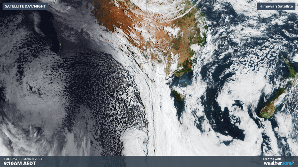
Image: Himawari-9 satellite image showing the three hours leading up to 12:10pm on Tuesday, March 19.
The satellite images above also show a large region of speckled cloud in the Bight and Southern Ocean behind this cold front. This broad area of speckled cloud is a tell-tale sign that a large mass of cold polar air has broken away from the Antarctic region and is venturing into the relatively warm mid-latitudes.
The leading edge of this frigid air is expected to bring the coolest airmass so far this year into parts of NSW, with the temperature expected to drop 5-10 °C in three hours as the change sweeps through.
The southerly buster is expected to arrive in Sydney between 2:30 and 4:30pm local time on Wednesday, with sustained winds of around 40 to 60 km/h and gusts of 70 to 90 km/h forecast with and behind the change.
The map below shows the strong southerly wind gusts impacting the central and southern coast on Wednesday afternoon in the wake of the change.
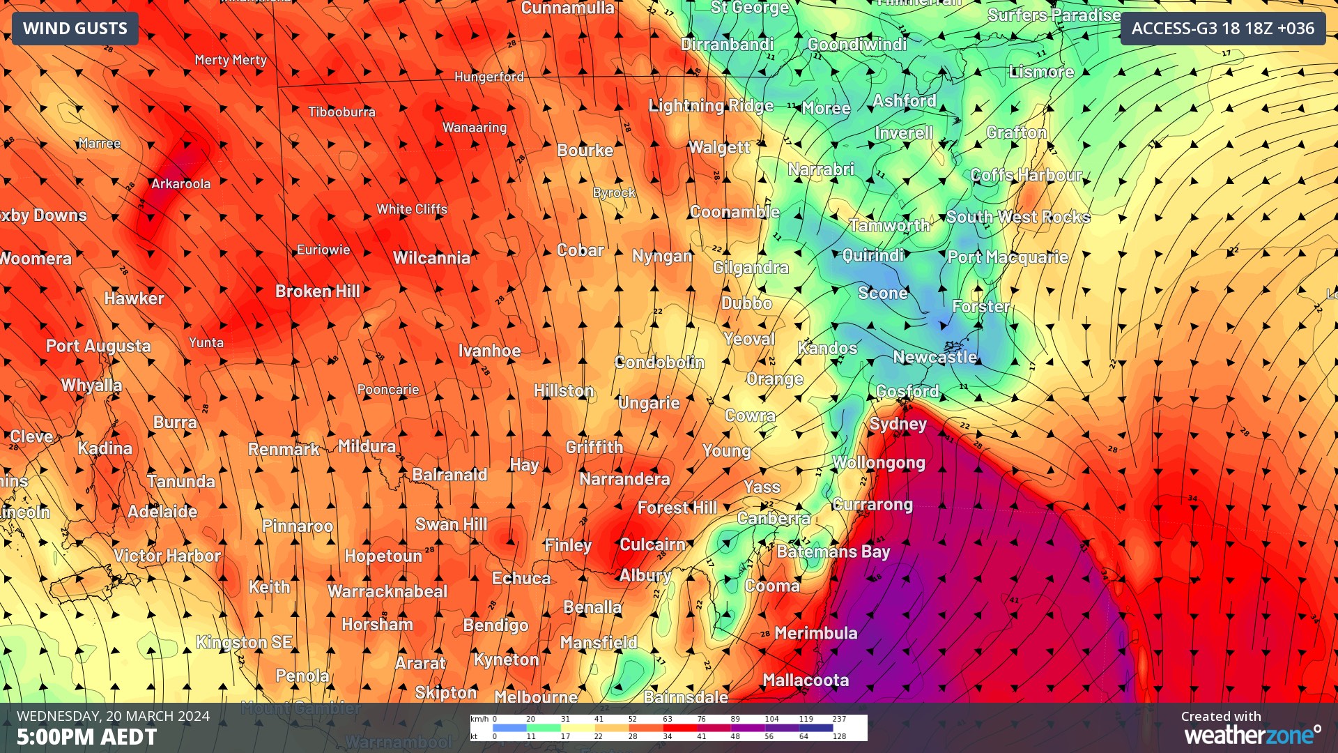
Image: Instantaneous wind gust forecast at 5pm AEDT on Wednesday, March 19, according to ACCESS-G.
While winds will remain brisk on Thursday, they should ease later in the day as the cold front moves further east over the Tasman Sea.
The strong southerly winds will also whip up a pulse of large swell, which will move up the coast on Wednesday. The swell is forecast to reach 3.5 metres along the Sydney coast and up to 5 metres off the state’s South Coast.
The map below shows the large significant wave heights impacting central NSW early Thursday morning.
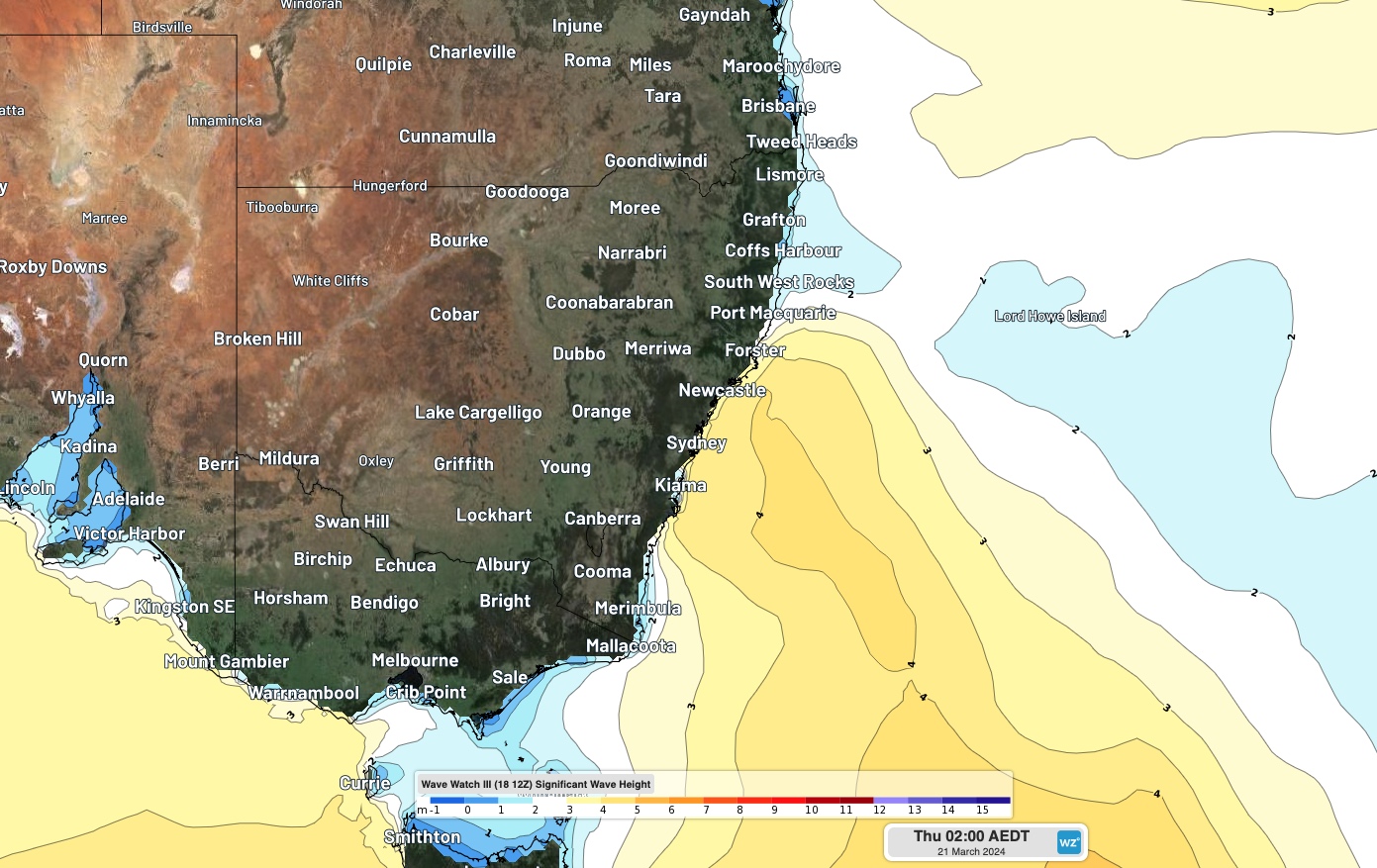
Image: Wave watch III significant wave height forecast for 2am on Thursday, March 21.
This swell will ease across southern and central NSW by Thursday evening and ease across northern NSW by Friday morning.