
Signs indicating Australia's cool season arrival
Mere hours after our Total Lightning Network went quiet over the Australian continent, the Himawari satellite captured a clear, textbook snapshot of the arrival of Australia's cool season.
A few distinguishing features should catch your eye:
- A band of cloud streaming over northern WA and towards the nation's interior
- A distinct clearing of cloud from most of the NT's Top End, and
- A band of cloud crossing to the south of WA
Turns out, all three of these features point to one thing: winter is knocking at the door.
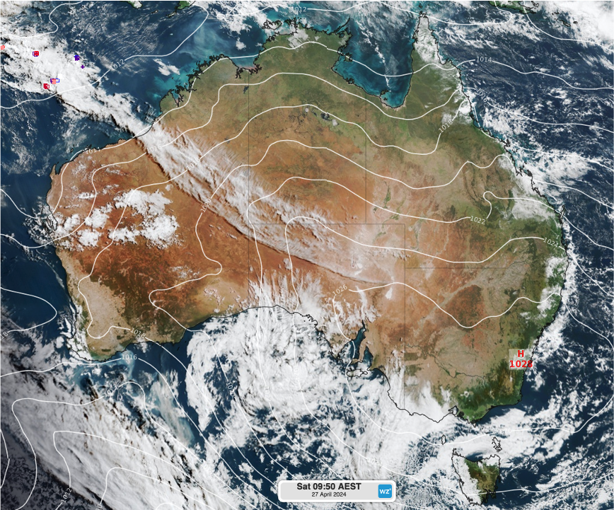
Image: Himawari satellite imagery and mean sea level pressure (ECMWF) over Australia on the morning of Saturday, April 27th, 2024.
1. Subtropical jet migration
If you follow our weather stories, this might seem vaguely familiar; the last time we mentioned a similar weather pattern was last July, during the heart of winter.
One of two main jet streams affecting the Australian region, the more northward subtropical jet stream, is shifting north and bringing across warmer, humid air from the Indian Ocean. As this air travels with the stream over the Australian mainland, it meets with cooler air and rises over it, producing wispy, high level cirrus cloud.
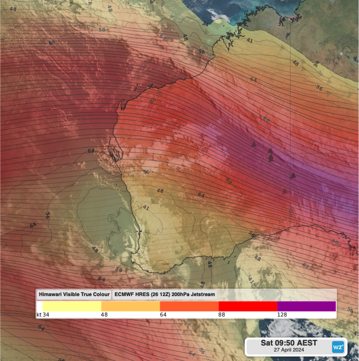
Image: 200hPa jetstream winds (ECMWF) overlaid on Himawari satellite imagery from Saturday morning.
2. The northern dry season
Whilst not officially starting until May, northern Australia is beginning to show signs of the dry season, as the humid winds start to turn more southeasterly, decreasing moisture.
The dry season marks a six month period of clearer skies and drier (often gusty) interior winds, particularly over the Northern Territory. Maximum temperatures still reach the low 30s during the Top End's dry season, which is also its fire season.
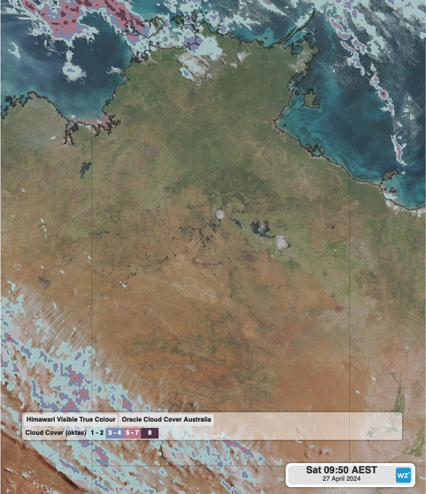
Image: Oracle cloud cover, expressed in oktas, overlaid on Himawari satellite imagery from Saturday morning, showing largely clear skies over the Northern Territory. 0 oktas indicate clear skies, while 8 oktas indicate completely cloudy skies. High jet stream cloud can be seen over the bottom left of the image.
3. Cold fronts
Cold fronts can cross the Australian Bight at any time of year but are generally suppressed during the warmer months as the 'subtropical ridge', or broad area of high pressure, tends to be over the south of the continent at this time, steering fronts well into the Southern Ocean.
During cooler months, this ridge generally shifts north to central Australia, allowing fronts to propagate from west to east over southern parts of the country, bringing enhanced wind and showers.
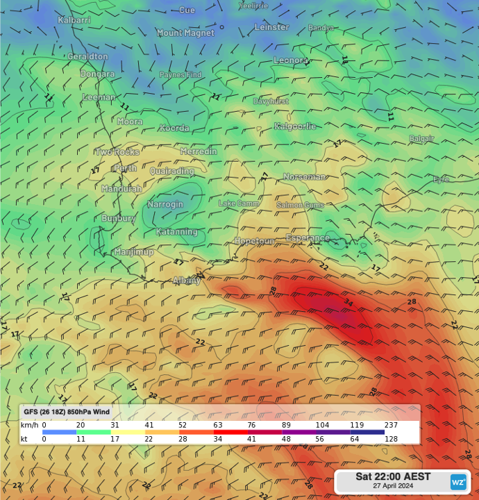
Image: Forecast 850hPa winds (GFS) as a cold front crosses south of WA on Saturday evening. Because this front is further south than the mainland, areas including Perth look to miss out on significant winds and rainfall.
As we move into the cold season, cold fronts and other wintertime systems should start to impact southern Australia, while the dry season takes hold of the north. Therefore, be sure to keep up to date with the latest warnings and forecasts.