
Powerful waves to impact port operations
Deceptively powerful surf is forecast for this weekend, as heavy waves originating from the Southern Ocean hit the NSW coastline.
The heavy surf will be whipped up by a low-pressure system sweeping across the south of the continent later this week.
The map below shows wave heights of 3-4m are expected across the central and southern NSW coast on Friday and Saturday.
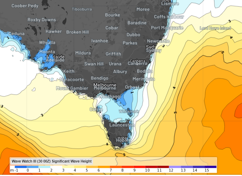
Image: Significant wave height forecast at 5pm Saturday, February 3 according to Wave Watch III
In Sydney waters, wave heights are forecast to peak at 4 to 4.5 metres on the weekend. These wave heights will create very rough seas off the Sydney and Illawarra coasts on the weekend.
While the waves will be large, it's the wave period that will generate the deceptively powerful surf.
Wave period is the average time between crests (or troughs) of waves. The larger the time difference, the greater the amount of energy associated with the waves or swells.
The wave period should reach 10-12 seconds along the Sydney coast and south on Saturday.
The map below shows the high period waves impacting the central and southern coastline on Saturday.
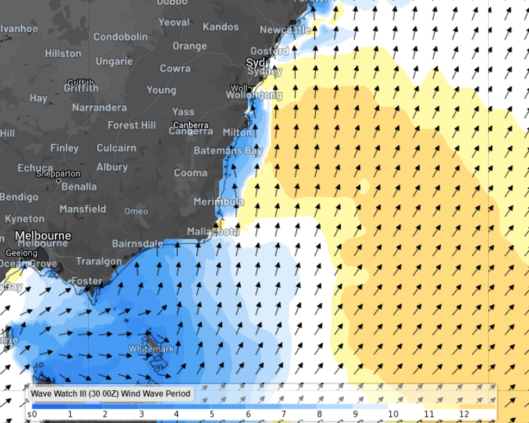
Image: Wind wave period at 4pm on Saturday, February 3, according to Wave Watch III
Looking ahead, the long period swell should move offshore by Monday easing conditions along the NSW coastline.
Weatherzone Business offers a comprehensive suite of services, refined through years of collaboration with the marine, ports and offshore industries, to optimise the safety and efficiency of your operations. For more information, please contact us at business@weatherzone.com.au.