
Melbourne weather strongly out of character
"If you don’t like the Melbourne weather, just wait five minutes."
So goes one of many sayings about Melbourne's famously changeable weather, which can swing wildly from minute to minute, hour to hour, and day to day.
But for the past two weeks, Melbourne’s weather has been behaving in a decidedly un-Melbourne-like manner. In short, it has been extremely steady and predictable.
READ MORE: REMARKABLY UNREMARKABLE WEATHER
April 2024 started with a surge of warm air and a top temperature of 28.2°C before dipping to a maximum of just 16.6°C on April 3. That was a taste of the fluctuating Melbourne weather so many people know and love. Or even if we hate it, we love to hate it because it's just so very Melbourne.
But since April 3, there has been a remarkably uniform pattern to the daily maximums, which have peaked just below 20°C most days, with a couple of days where the mercury tipped over 20°C. (You can view our daily summaries here)
- And for the rest of this week, the trend of coolish Melbourne max temps just below 20°C is set to continue with highs of 17°C, 18°C, 18°C, 18°C and 18°C predicted from Wednesday through to Sunday.
- We should also mention that Adelaide has also seen a month remarkably free of dramatic temperature fluctuations, with a lowest maximum of 18.8°C and a highest max of 22.8°C to date.
Why the steady daytime temps?
We've written often in recent weeks about the influence of the persistent blocking highs centred south of Australia. These systems continue to prevent much-needed rain-bearing cold fronts from reaching southwest WA, where a record-breaking dry spell continues, and they also tend to bring stable weather to Victoria and South Australia.
We could literally pick the synoptic chart from almost any day this month to illustrate this situation and Wednesday's chart will do nicely.
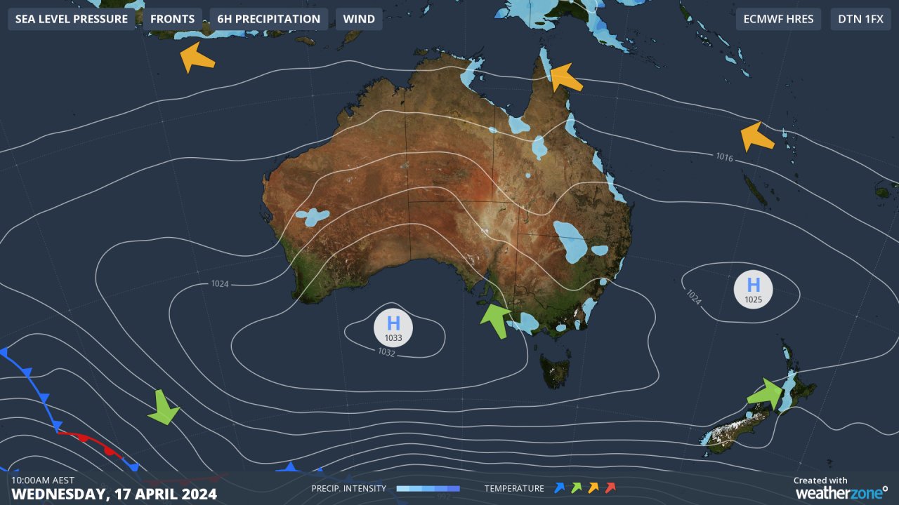
That strong high centred south of the Bight is delivering generally fine weather to almost the entire country. It’s also pushing southerly winds the way of Adelaide and Melbourne which explains why average max temps for both cities are ever so slightly down on average for April 2024 to date.
Only very light showers are affecting Australia's southern coastline so in both Melbourne and Adelaide, you can expect cool but stable conditions for the rest of the week.
If you're a Melbourne or Adelaide local, enjoy the current lack of uncertainty in the weather! As we all know, it's certain not to stay that way.