
Forecast for the 2024 Rip Curl Pro Bells Beach surf competition
A relatively early Easter this year will make for a tricky outlook for the first World Surf League surf competition at Bells Beach.
The iconic Bells Beach Pro, competitive surfing’s longest running event, is expected to start up this week. The event window, which has usually encompassed the Easter long weekend since 1961, allowing surfers to take the drive down from nearby states, will run this year from Tuesday March 26th till Friday April 5th. The early position of Easter on the calendar this year will make for a tricky event to navigate for the organisers, fans and surfers. At this time of year, the northwards transition of the sub-tropical ridge can lag behind enough to prevent strong Southern Ocean lows and cold fronts from moving near or over the Australian region, leading to weaker swell and less favourable winds.
This pattern of high pressure looks to plague a broad portion of the waiting period, however a moderate swell from deep in the Southern Ocean will move into the region on Monday, and will likely be sufficient to have a good day of surfing for the opening day on Tuesday 26th. Surf size will be in the 5 to 6 foot range, with early winds being most favourable, before a south-to-southwest wind brings a ruffle to the wave texture in the afternoon. On Wednesday 27th, surf size will have dropped a fair bit, possibly into the 3 or 4 foot range, with early winds remaining more favourable before a stronger southerly kicks in into the afternoon.
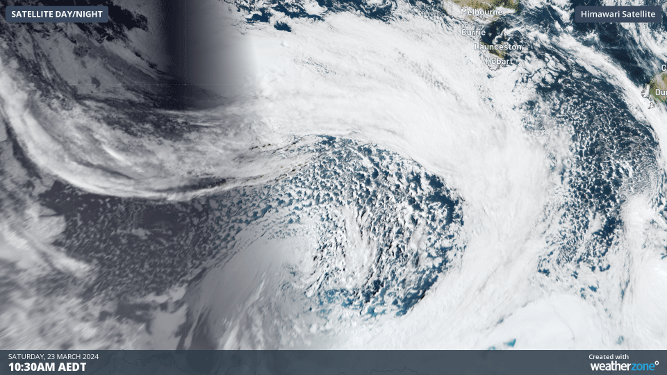
Satellite imagery deep over the Southern Ocean, near Antarctica, on Saturday March 23rd showing the swell generating front moving towards Australia.
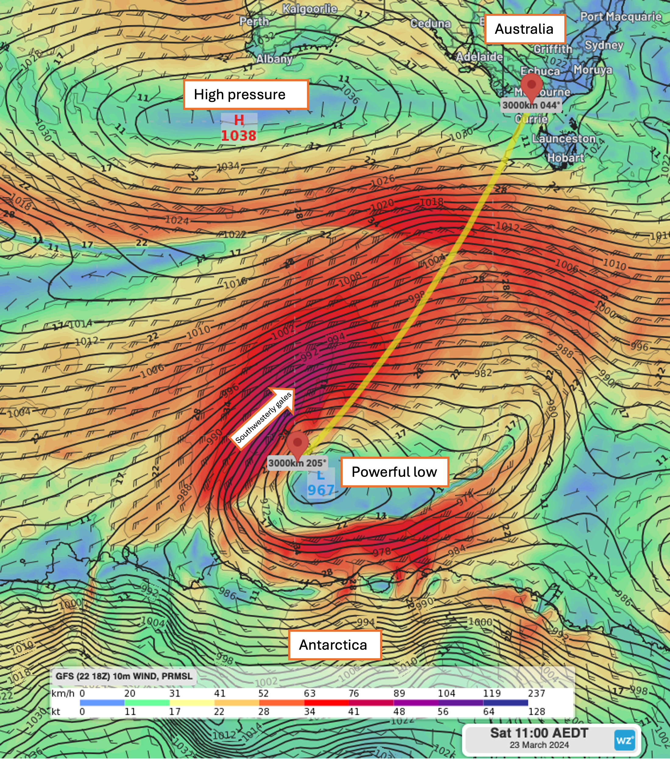 Model winds and mean sea level pressure on Saturday March 23rd showing the swell generating low and front moving over the Southern Ocean.
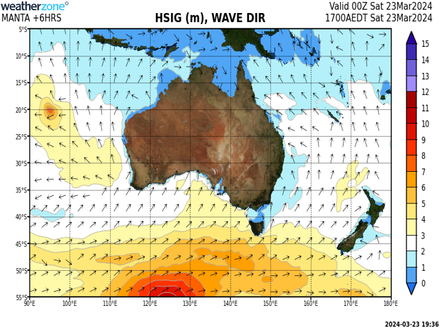
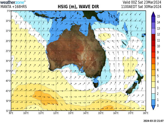
Model forecast swell reaching around 10 metres on Saturday 23rd afternoon generated by the deep low and front over the Southern Ocean.
Organisers will likely want to make the most of this first day, or day and a half, of the event window, as a dominant blocking high will move over and generally remain near stationary from Wednesday onwards, subduing the generation of moderate-to-large swell required to make the Bells bowl break.
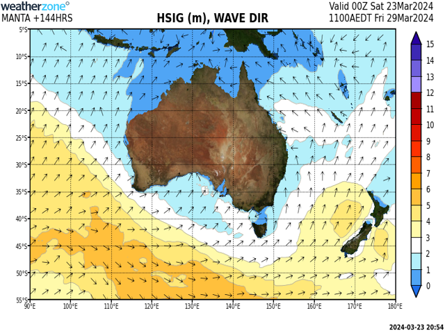
Model forecast swell on Friday 29th showing small wave heights across a broad region to the south of Australia.
Looking further ahead, this blocking high pattern could break down over Easter weekend, allowing a more south-to-north progression of fronts late in the waiting period, possibly from as early as Monday 1st or Tuesday 2nd. While this is quite a fair bit out, this might be the opportunity the event organisers will be waiting on to make for the most contestable conditions for the best surfers in the world.
Model forecast swell on Saturday 30th showing potential for another system moving towards southern Australia, most likely only reaching the Victorian coast after Monday 1st.