
Satellites capture huge dust storm crossing Mediterranean Sea
Images captured from satellites have revealed the colossal scale of a dust storm that turned the sky orange in parts of Greece earlier this week.
Southern areas of Greece were shrouded by a dust storm on Tuesday, April 23, which originated in the Sahara Desert before travelling across the Mediterranean Sea to Greece.
Αττικ?, απ?γευμα Τρ?της 23 Απριλ?ου 2024... απ? τις κ?μερες του https://t.co/zg4f82dQZ6#Athens #dust pic.twitter.com/aOVZLxQQTL
— meteo.gr - Ο καιρ?ς (@meteogr) April 23, 2024
The country’s capital Athens became an eerie sepia scene as the Saharan dust filled the late afternoon sky, providing a unique orange backdrop for the Acropolis.
Here’s another look at the Acropolis under the Sahara dust cloud moments ago.#Greece pic.twitter.com/rKEvEypc1S
— Derek Gatopoulos (@dgatopoulos) April 23, 2024
Meteorologists in Greece gave warnings of the impending Saharan dust storm and the potential for mud rains at the start of the week. On Tuesday, high-resolution satellite images confirmed their forecasts, capturing clear images of the dust sweeping from the Sahara to Greece.
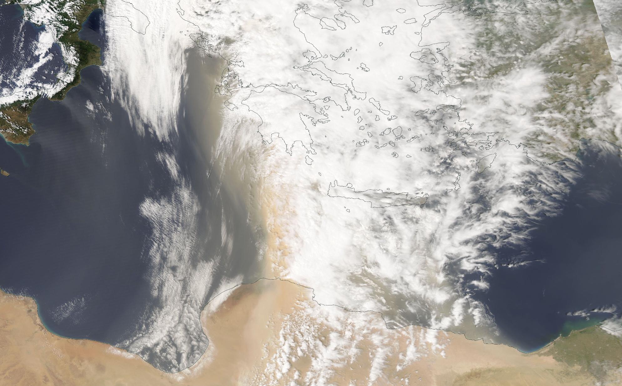
Image: Airborne dust extending from the Sahara Desert towards Greece in Tuesday, April 23, 2024. Source NASA Worldview / Aqua satellite
This week’s dust storm was caused by an area of low pressure passing over the Mediterranean Sea, driving southerly winds laden with dust towards Greece.
It is not uncommon for Saharan dust towards southern parts of Europe, with a similar event turning French snow brown in the Pyrenees back in 2021.