
Active Systems
Unlock more weather data and layers options
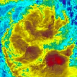
Understanding the Track Map
The symbol with a red background indicates the observed positioning of the tropical cyclone.
The symbol with a white background and black outline indicates previously observed positioning of the tropical cyclone.
The symbol with a white background and grey outline indicated a forecasted position of the tropical cyclone. The number indicates the intensity of the tropical cyclone, from 1 to 5 (5 being the most severe). An ‘L’ symbol represents a Tropical Low (ie. an intense low pressure system, but not technically a tropical cyclone). Forecasted positions are usually only shown for the next 72 hours.
The red rings indicate the size and extent of the destructive winds. The dark red colour represents hurricane-force winds (>117 km/h), the light red colour indicates storm-force winds (>89 km/h), and the extra light red colour indicates gale-force winds (>63 km/h).
The arrows indicate the projected direction (track) of the tropical cyclone
Land-mass regions coloured in red/pink indicate ‘warning areas’ that will be severely affected.
Land-mass regions coloured in yellow indicate ‘watch areas’ that should be monitored.
Understanding Tropical Cyclone Categories
CATEGORY 1 (tropical cyclone)
Negligible house damage. Damage to some crops, trees and caravans. Craft may drag moorings. A Category 1 cyclone's strongest winds are GALES with typical gusts over open flat land of 90 - 125 km/h.
CATEGORY 2 (tropical cyclone)
Minor house damage. Significant damage to signs, trees and caravans. Heavy damage to some crops. Risk of power failure. Small craft may break moorings. A Category 2 cyclone's strongest winds are DESTRUCTIVE winds with typical gusts over open flat land of 125 - 164 km/h.
CATEGORY 3 (severe tropical cyclone)
Some roof and structural damage. Some caravans destroyed. Power failures likely. A Category 3 cyclone's strongest winds are VERY DESTRUCTIVE winds with typical gusts over open flat land of 165 - 224 km/h.
CATEGORY 4 (severe tropical cyclone)
Significant roofing loss and structural damage. Many caravans destroyed and blown away. Dangerous airborne debris. Widespread power failures. A Category 4 cyclone's strongest winds are VERY DESTRUCTIVE winds with typical gusts over open flat land of 225 - 279 km/h.
CATEGORY 5 (severe tropical cyclone)
Extremely dangerous with widespread destruction. A Category 5 cyclone's strongest winds are VERY DESTRUCTIVE winds with typical gusts over open flat land of more than 280 km/h.